

Stamford Ramblers
Walks & Cycling
Local walking group also known as Stamford, Bourne & The Deepings Ramblers, formed in 1980. Organises regular rambles of 6-15 miles for roughly 340 members across Bourne, Stamford and the Deepings.
Walking routes, cycle routes, parks, outdoor activities
Local walking group also known as Stamford, Bourne & The Deepings Ramblers, formed in 1980. Organises regular rambles of 6-15 miles for roughly 340 members across Bourne, Stamford and the Deepings.
Carp and coarse fishing lake at Home Farm Touring Park, The Fen, Baston, near Bourne (PE6 9PU). Fishing is available to campers staying on the 41-pitch touring park, set in four acres overlooking the lake.
Abbey Lawn is Bourne's principal recreation ground, hosting the town's cricket, tennis, bowls, petanque and football clubs. Opened in 1911 for George V's coronation, it also hosts Guy Fawkes Night celebrations and travelling fairs.
Public park on Manor Lane, Bourne, covering about 32.8 acres with ponds, mature trees and a children's play area. Preserved as open space by Bourne United Charities since 1945; hosts major bank-holiday community events.
Free community woodland play space of about 5.5 acres just north of Little Bytham, near Stamford - some distance from Bourne. Features wooden play structures including a zip wire and rope swings, maintained by volunteers for the charity Bythams Woodland Trust.
Section of the 290-mile Macmillan Way long-distance footpath, which runs just south of Bourne near Kate's Bridge. Raises funds for Macmillan Cancer Support along its route and offers a waymarked waterside walk along the River Glen.
Semi-natural oak and ash woodland covering around 319 acres near Aslackby, roughly 7 miles north of Bourne. Managed by Forestry England as part of Kesteven Forest, with a gateway car park and trails for walking, cycling and horse-riding.
8-hectare Local Nature Reserve at Witham Road, Witham-on-the-Hill, near Bourne (PE10 0JN), managed by Lincolnshire Wildlife Trust. A former sand pit turned wildlife habitat with 50+ recorded bird species; free access, no dogs except assistance dogs.
Large reservoir and country park in Rutland, around 14-19 miles (25 minutes' drive) from Bourne. England's largest reservoir by surface area, popular for birdwatching, sailing and cycling.
Ancient woodland (46 hectares) on the edge of Bourne, dating back to the 1600s, with a 6.3km circular walking trail crossing the A151 and A15. Popular for bluebells in spring; recently affected by ash dieback felling work.
Conservation area with wildlife ponds and water-level weirs, on former farmland between southern Bourne and Math/Elsea Woods. Part of the wider Elsea Park development, Bourne's largest housing estate (around 1,500 homes built, 1,000 planned).
Woodland near Dunsby village, about 4 miles north of Bourne off the A15, on the edge of the Lincolnshire Fens. Sits near the Haconby parish boundary; limited distinct online information found beyond its general location.
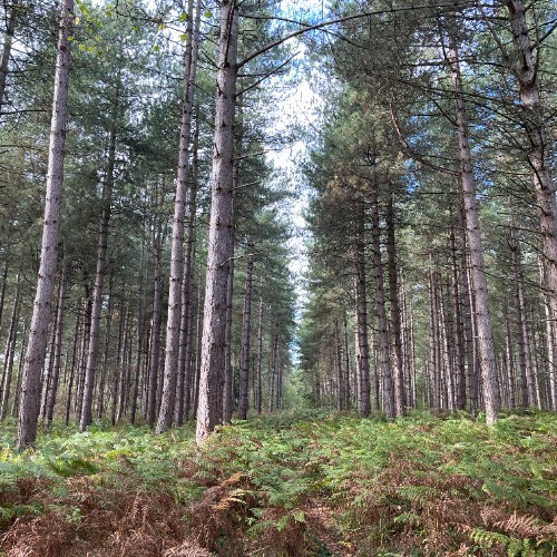
400-acre Forestry Commission woodland (Bourne Wood and Fox Wood) on the western edge of Bourne, with ancient mixed conifer and broadleaf woodland. Offers walking, cycling and horse-riding trails plus ponds where herons and kingfishers can be spotted; postcode PE10 9RD.
Small ancient woodland nature reserve (6.6 acres) about 2.5 miles south of Bourne near Thurlby, managed by Lincolnshire Wildlife Trust since 1975. A remnant of the historic Brunswald Forest, known for bluebells, oak and hazel coppice, and woodpeckers and other birdlife.
SSSI wetland nature reserve covering 35 hectares, about three miles southeast of Bourne. Managed by Lincolnshire Wildlife Trust; originally created as 17th-century washland flood storage, it now hosts over 300 plant species and 160+ bird species.
Free outdoor concrete skatepark (also known as Dimension Skatepark) at Abbey Lawns, Coggles Causeway, Bourne. Opened in May 2023 after a 20-year community campaign; owned and run by Bourne Town Council.
Wake Pond, a small pond and green space near Wake House in Bourne town centre. A peaceful spot featured on local walking trails, close to the town's shops and historic buildings.
Pond and green-space feature within the Elsea Park development in Bourne, near Jubilee Green Playground. Surrounded by new housing and play areas rather than a business; close to Bourne Castle and Bourne Grammar School.
Community orchard off Beech Avenue next to Bourne Wood, planted in 2012 by the Friends of Bourne Wood on Forestry Commission land. Apple, crab apple and cherry trees with benches and picnic tables; open for quiet enjoyment on weekends, 10am-6pm.
Forestry Commission (Forestry England) forest office on Beech Avenue, Bourne, which owns and manages Bourne Wood. Bourne Wood is about 400 acres of public woodland on the town's western edge, with walking trails and a car park off the A151.

If your business, group or organisation belongs in this category, add it to the directory for free.